
03 / 3D WORLDS
BRING A PLACE BACK WITH YOU.
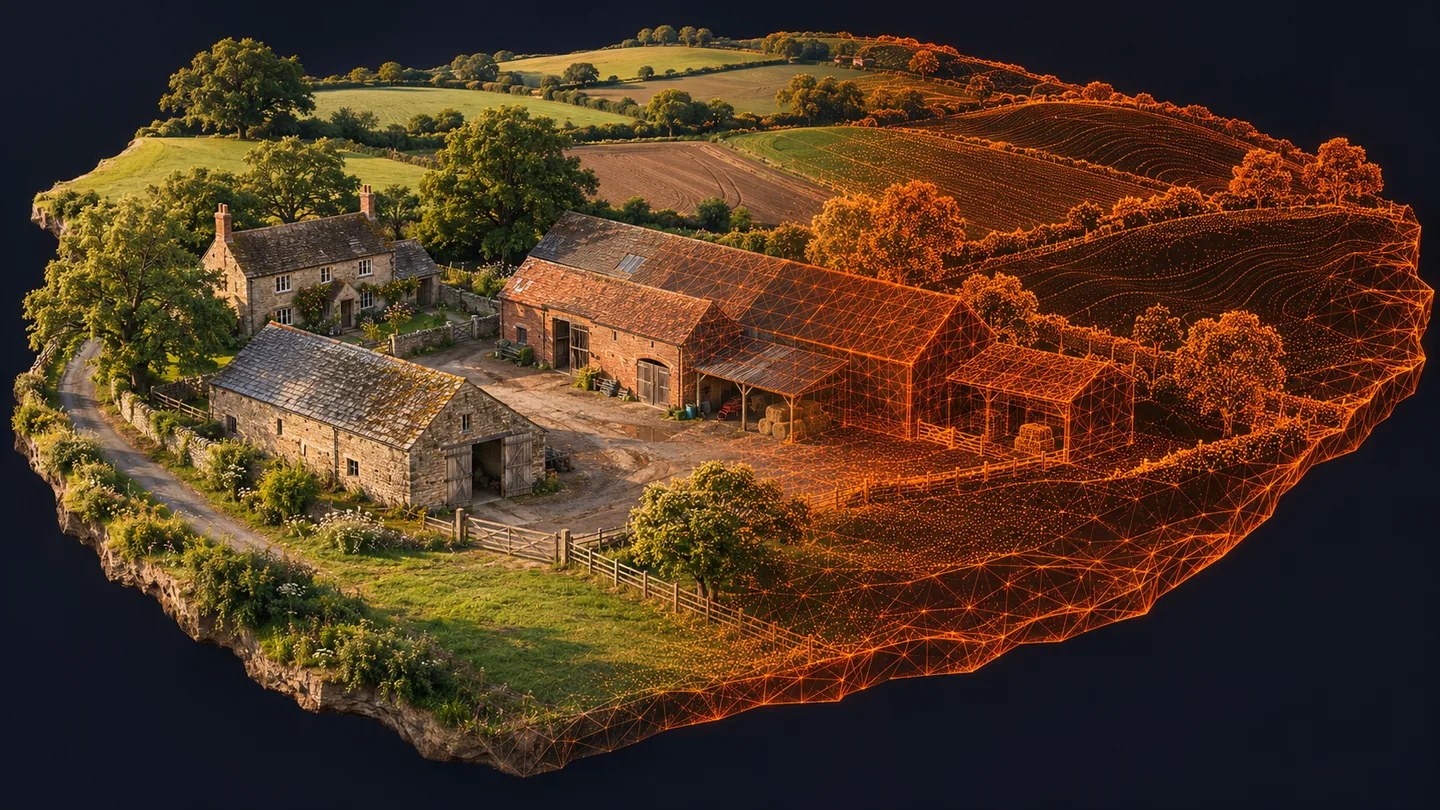
A farmyard becomes more than a photograph. Walk around its structure, explore its surfaces, and understand how the reconstruction was made.
FIELD GUIDE / 19 NOV 2026
A roof is only the beginning.
A downward grid sees roofs and ground very well. It sees much less of walls, overhangs, doors and sheltered spaces. To reconstruct a place in three dimensions, the camera needs to meet those surfaces from different directions, with enough shared detail to connect one view to the next.
Imagine photographing a barn as if you were explaining its shape to somebody who had never seen it. A single overhead frame gives the footprint. A sequence of oblique frames reveals the roof pitch and the relationship of the walls. Further views connect the corners. The software triangulates shared features across those photographs; it cannot reliably reconstruct a surface that was never visible.
Crosshatch and oblique capture
A crosshatch adds a second grid roughly perpendicular to the first. This gives features additional directions of observation and can strengthen geometry, especially when combined with obliques. Litchi Hub added 3D-model and crosshatch area-mapping options in June 2026. Select the Mavic 2 Pro / original-app path and inspect what the generated flight actually transfers to your iPhone.
For a simple building complex, use an overview grid to connect the site, then overlapping oblique passes or partial orbits that see the walls and roof edges. A camera pitch around −45° is a useful concept to explore, not a compulsory setting for every building. Different distances and heights change both the apparent scale and what is hidden. Maintain generous clearance and keep the aircraft in direct view; a complete circle is not useful if the building blocks your sight of it.
One capture. Several very different results.
| Product | What it is | A useful application | A limitation |
|---|---|---|---|
| Sparse point cloud | Matched features and the initial camera solution | Checking camera alignment and site coverage | Not a detailed representation of every surface. |
| Dense point cloud | Many reconstructed 3D samples, often with colour | Inspecting geometry and deriving surfaces | Noise and missing surfaces still need inspection. |
| DSM | A raster of visible upper-surface elevations | Understanding roofs, canopy and broad relief | Does not automatically represent bare-earth ground. |
| DTM | Estimated terrain after ground classification / interpolation | Terrain interpretation where ground is adequately visible | Cannot measure hidden ground through dense vegetation. |
| Textured mesh | Connected triangles with image-derived texture | A model that can be viewed from different angles | Texture can conceal weak geometry; holes are not measured surfaces. |
| Gaussian splat | A radiance representation made of many blended 3D elements | Photorealistic exploration from suitable nearby viewpoints | Not automatically a watertight surface or a measurement-ready mesh. |
Keep the distinction visible when presenting results. If you are showing a mesh, offer a wireframe or untextured view as well: it helps reveal where the geometry is solid and where an attractive photograph is doing most of the work. If you are showing elevation, explain whether it is a surface or terrain product and what control supports its vertical accuracy.
A good model is not necessarily the heaviest export. Keep a full-quality master, then make a sensible viewing derivative. Large point clouds and textures can overwhelm a phone long before they overwhelm a desktop. Use progressive viewers or reduced-density previews where available, and offer the source product separately when a technical user needs it.
Your first farmyard reconstruction.
Choose a small, static site where you have permission and can operate legally. A working farm brings vehicles, livestock, wires, employees and public access into the planning picture. Arrange a suitable quiet period rather than trying to capture everything while the yard is busy. A farmyard is not automatically an acceptable A3 location simply because fields surround it.
- Write a capture inventory. List the ground, roofs and walls you intend to see. Mark the hidden sides and safe observation positions. Decide whether a ground-based camera can fill gaps more safely than a closer drone pass.
- Capture the broad structure. Begin with consistent, sharp full-resolution photographs and enough overlap to connect the entire area. Keep exposure and focus stable. Avoid switching between wide and cropped camera views mid-sequence.
- Add oblique coverage. Plan controlled passes from several sides and suitable heights. Use overlapping views at a reasonably consistent subject distance, with cross-links between sequences. Check that corners appear in more than one set.
- Inspect before leaving. Review the actual photographs, not just the flight-line drawing. Look for unseen walls, sky-heavy frames, blur and blown highlights. Capture a missing surface while the light and site are still consistent.
- Process a manageable set. Start a WebODM project and inspect the camera solution before judging the texture. Retain surveyed control and independent checks when measurements matter. Document any masking or excluded images.
- Examine from unexpected angles. Rotate the model, inspect undersides and roof edges, and compare against the source photographs. A model can look perfect from the capture direction and fail from the opposite side.
- Export with context. Include capture date, equipment, coordinate reference, control method and known omissions. For a visual portfolio piece, say so. For measurement, provide validation and appropriate professional review.
Why some surfaces refuse to behave
Water reflects a changing sky. Windows show a different scene from every viewpoint. Leaves and people move between exposures. Large plain walls offer few distinctive matching features. These are not problems solved simply by clicking “ultra quality”. Improve capture geometry and conditions, mask troublesome areas when justified, and accept that some surfaces will remain incomplete.
Gaussian splatting: presence, with caveats.
A textured mesh builds connected surfaces. A Gaussian splat represents the scene through many overlapping, softly weighted 3D elements whose appearance changes with viewpoint. With suitable photographs it can reproduce a striking sense of presence, including fine visual detail that a modest mesh may struggle to convey.
That visual richness does not automatically make it a stronger measurement tool. A splat may look convincing without providing a clean surface for dimensions, volumes or fabrication. Judge the product by the intended use: an immersive visit, a visual record and a validated engineering model have different requirements.
The current WebODM path
- Process an RGB photogrammetry dataset with good oblique or orbit coverage.
- Open the completed task’s menu and choose Splats.
- Download its training-data ZIP containing the image/camera information needed by the next tool.
- Train externally using a supported program. OpenSplat has macOS/Metal support; Brush provides WebGPU-based options. Check the current installation instructions and hardware needs for the chosen tool.
- Upload the resulting supported splat model back to WebODM for viewing alongside other products.
This is not a promise of a one-click training button that works on every Mac. A 16 GB Apple Silicon machine is a sensible place to experiment with a small scene first. Training load, image sizes and implementation choices matter. Purely nadir field grids are poor inputs for an immersive scene because the sides were barely observed.
A digital twin needs more than a handsome model.
A one-off reconstruction is a digital record of a place. A useful digital twin adds identity, dates, repeat observations and a maintained link to the real site. For a farm, that might mean a baseline model connected to roof inspections, drainage observations and later changes. The value is in the reliable history, not in giving a 3D file an impressive name.
Keep a consistent coordinate framework, preserve originals and version the outputs. Explain what changed between captures and what may be a reconstruction artefact. Store observations separately from the measured geometry. If a building moves, a surface changes or control is corrected, the record should show why the model differs.
Start small: one well-documented yard, one clear question, one repeat visit. A modest reconstruction you can explain and validate is more useful than a spectacular scene nobody can trust.
Go to the source.
Primary documentation, specifications and research checked on 19 November 2026. Recheck before installing software or flying.